Case study
Coed Y Brenin – Structured introduction of risk for Mountain Bikers
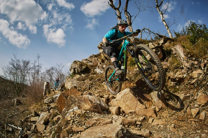
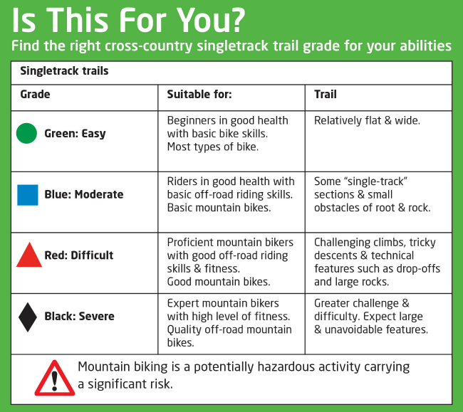
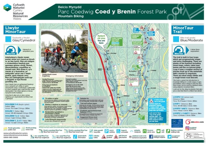
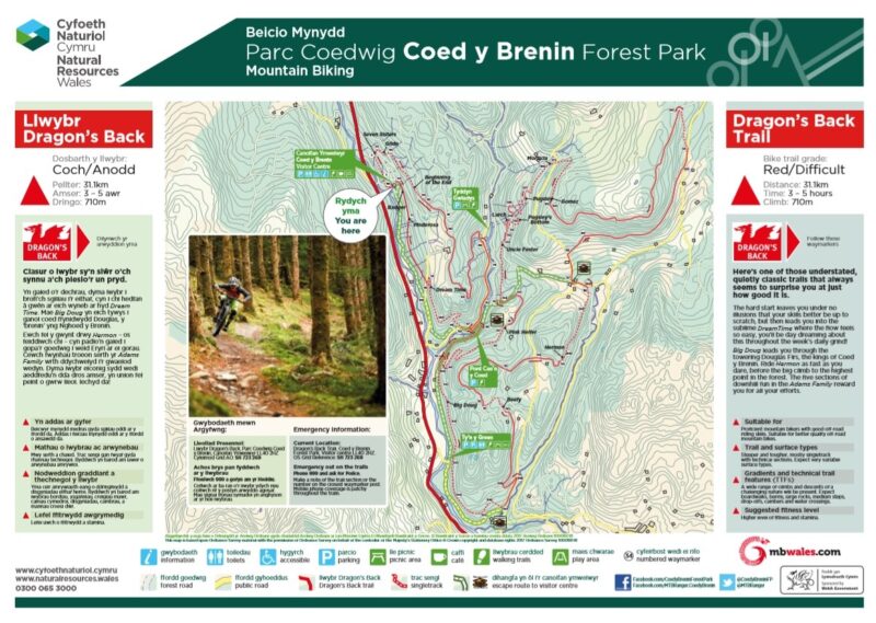
Coed y Brenin Forest Park contains 150km of graded waymarked mountain bike trails and a purpose-designed skills area. The Skills Area enables riders to assess their mountain biking skills. The first decision point offers riders trails of Green (Easy), Blue (Intermediate), Red (Difficult) and Black (Severe). The difficulties are clear to the eye before riders depart, and signs encourage them to “Start easy and progress until you find your level”.
The routes require riders to take responsibility for their own safety; the higher the grade, the higher the level of technical ability and fitness is expected of participants.
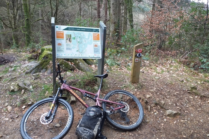
All the trails are graded and clearly signed so that cyclists do not inadvertently take on terrain that is beyond their capability. A trailhead panel gives the grade, distance, amount of climbing and an estimated time for completion. It shows the Icon symbol to be followed at each decision point on the trail. The first way-marker always has an “Is this trail for you?” reminder below the icon symbol.
There is emergency access to the skills area and evacuation practice is regularly carried out with the local mountain rescue team. Helicopter landing is available nearby.
Natural Resources Wales staff carry out regular inspections and complete quarterly written reports on the condition of the Skills Area. Regular maintenance throughout Coed y Brenin ensures that riders find conditions on the trails exactly as described.
Visitors can access consistent safety and grading information from three sources before they start a trail:
- before they leave home by viewing or download from the mbwales.com website
- on arrival, in the trail leaflet (available in the visitor centre)
- again at the Trailhead panels on site.
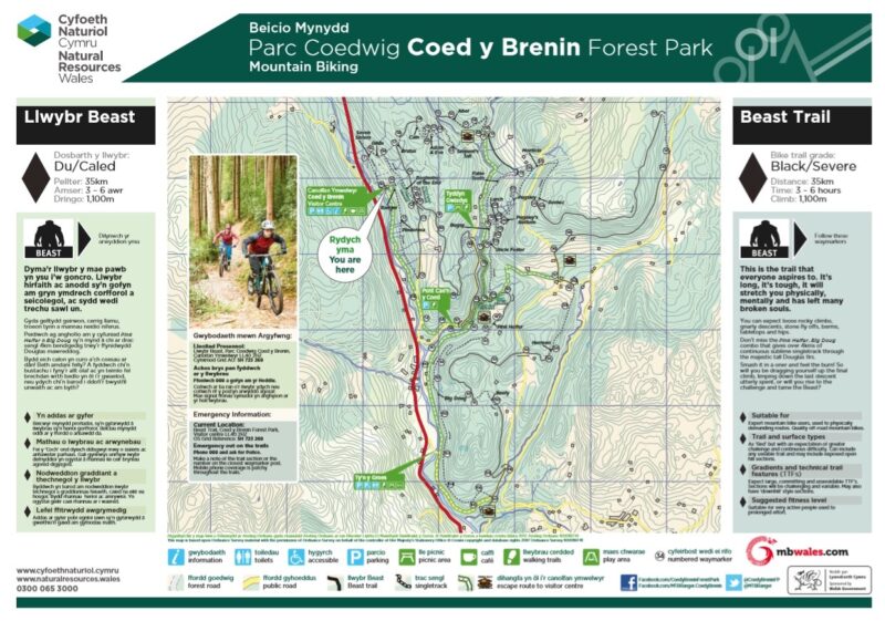
Examples of Coed y Brenin Trail Route Maps:
- asset value
- balancing risk and benefit
- children
- coast
- cycling
- developed/urban
- falls from height
- forest & woodland
- historic building
- Ireland
- no nasty surprises
- paths
- play
- risk assessment
- signs
- slips, trips & falls
- swimming
- undeveloped/remote
- Wild Camping & Campervans
- Wildfires
- willing acceptance of risk
- zoning
- Members only
- Public (everyone)
- Subscribers & Members
Back to case studies